


 Feed
Feed Scan with QR Code Reader
 mobi
mobi- Advertise / Donate
Welcome !
Newquay weather receives over 1000 vistors per day winter time, rising to over 3000 to 4000 or more in the summer, including visitors from all over the world.
Please help support this site

Your business

Via Paypal
- Accommodation
Hotels, B&B's and Caravan and Camping Sites

Porth Sands - Luxury beach accommodation wth beach facing balconies, a golden sandy beach making it the perfect place to idle away the hours- swimming, body boarding, sunbathing and paddling.
- Food
Restaurants, Cafe's, Takeaways

Pachanga - Pachanga Authentic Mexican Since 2016 we've been re-creating dishes that are part of our cultural heritage using techniques that are unique to Mexico. We use mostly Mexican, local & organic produce in our dishes & drinks
- Charity Events
Charity Events - Max 3 free ads
For a Free Charity Ad Here, please contact me- - Houses for Sale
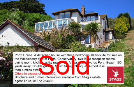
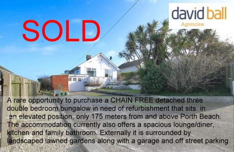
Houses for Sale
Advertise your house for sale here and help support this site.
Small photo, text + link to agents for a One off ₤25. Please contact me.Advertise your house for sale here
- Local Services
Shops, Services etc

Towan Insurance BrokersCornwall's local commercial insurance specialist. We help Cornish businesses find the right cover, from tradespeople and property owners to specialist contractors. Based in Cornwall, independent, and genuinely invested in the businesses we work with. Visit us at Towan Insurance Brokers
ESA - Observing the Earth News
| The European Space Agency (ESA) is Europe�s gateway to space. Its mission is to shape the development of Europe�s space capability and ensure that investment in space continues to deliver benefits to the citizens of Europe and the world. | |||||||||||||||||
|
 Image:
ESA’s Earth from Space series reaches its 1000th image with a return to the vibrant waters of southern Florida, Cuba and the Bahamas – the same region featured in the very first edition in 2004.
Image:
ESA’s Earth from Space series reaches its 1000th image with a return to the vibrant waters of southern Florida, Cuba and the Bahamas – the same region featured in the very first edition in 2004.


 Image:
The Meteosat Third Generation-Imager-2 (MTG-I2) satellite has arrived at Pariacabo harbour in French Guiana, ready to be transported to Europe’s Spaceport.
Image:
The Meteosat Third Generation-Imager-2 (MTG-I2) satellite has arrived at Pariacabo harbour in French Guiana, ready to be transported to Europe’s Spaceport. Image:


 Image:
On World Environment Day, the Copernicus Sentinel-2 mission brings us an amazing view from space of Baku, capital of Azerbaijan, hosting this year’s celebration.
Image:
On World Environment Day, the Copernicus Sentinel-2 mission brings us an amazing view from space of Baku, capital of Azerbaijan, hosting this year’s celebration. Image:
This Copernicus Sentinel-2 image features the Batagaika Crater in Siberia. This is the biggest permafrost crater in the world, caused by melting permafrost and also known as a ‘mega-slump’.
Image:
This Copernicus Sentinel-2 image features the Batagaika Crater in Siberia. This is the biggest permafrost crater in the world, caused by melting permafrost and also known as a ‘mega-slump’.  Video:
00:06:15
Video:
00:06:15
 Video:
01:45:00
Video:
01:45:00
 Video:
00:02:51
Video:
00:02:51
