🛰️
What is EPIC?
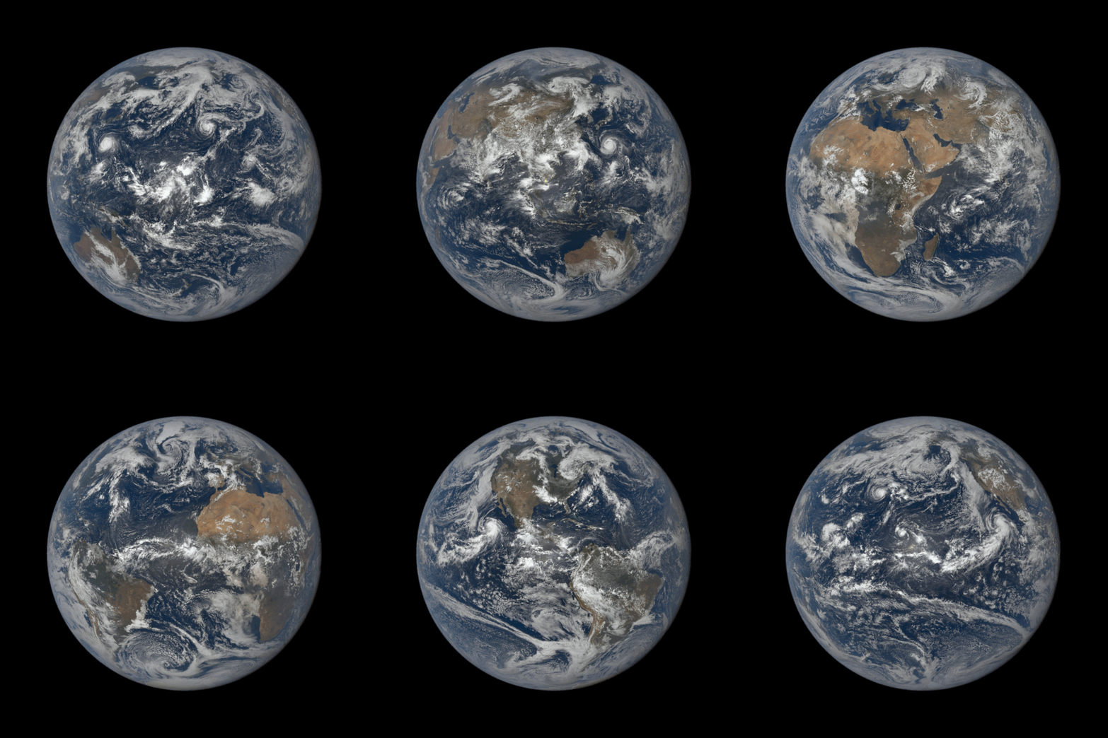
EPIC (Earth Polychromatic Imaging Camera) is a 10-channel spectroradiometer (317 - 780 nm) onboard NOAA's DSCOVR (Deep Space Climate Observatory) spacecraft.
EPIC provides 10 narrow band spectral images of the entire sunlit face of Earth using a 2048x2048 four megapixel CCD (Charge Coupled Device) detector coupled to a 30-cm aperture Cassegrain telescope.
This allows EPIC to provide full disc imagery of the Earth and captures unique perspectives of certain astronomical events such as lunar transits.
The DSCOVR spacecraft is located at the Earth-Sun Lagrange-1 (L-1) point giving EPIC a unique angular perspective that is used in science applications to measure:
- 🌤️ Ozone levels
- 🌫️ Aerosols
- ☁️ Cloud reflectivity
- 📏 Cloud height
- 🌿 Vegetation properties
- ☀️ UV radiation estimates at Earth's surface
L1 (Lagrangian Point 1) is a neutral gravity point between the Sun and Earth, about one million miles from Earth, where DSCOVR is located.
At this point, about a hundredth of the distance to the Sun, DSCOVR can maintain its position between the Sun and Earth.
L1 is a good position from which to monitor the Sun, because the constant stream of particles from the Sun (the solar wind) reaches L1 about an hour before reaching Earth.
📅 Images captured
Aug 24, 2026 12:50 AM →
Aug 24, 2026 10:39 PM
21 images in this sequence
• GIF uses 21 frames
✅ GIF is ready
⏰ Refreshed every 2 hours
🔄 Last updated: 2026-08-26 20:05:24
🖼️ 21 frames
📸 21 available
🕐 All times in Europe/London timezone
Showing 20 of 21 available images
(showing latest 20)

August 24, 2026 12:50 AM
Lat: 8.3276°, Lon: 174.4409°
This image was taken by NASA's EPIC camera onboard the NOAA DSCOVR spacecraft
View Full Size →

August 24, 2026 1:55 AM
Lat: 8.3130°, Lon: 158.0200°
This image was taken by NASA's EPIC camera onboard the NOAA DSCOVR spacecraft
View Full Size →

August 24, 2026 3:01 AM
Lat: 8.3057°, Lon: 141.6797°
This image was taken by NASA's EPIC camera onboard the NOAA DSCOVR spacecraft
View Full Size →

August 24, 2026 4:06 AM
Lat: 8.2690°, Lon: 125.2808°
This image was taken by NASA's EPIC camera onboard the NOAA DSCOVR spacecraft
View Full Size →

August 24, 2026 5:12 AM
Lat: 8.3057°, Lon: 108.8745°
This image was taken by NASA's EPIC camera onboard the NOAA DSCOVR spacecraft
View Full Size →

August 24, 2026 6:17 AM
Lat: 8.2544°, Lon: 92.5122°
This image was taken by NASA's EPIC camera onboard the NOAA DSCOVR spacecraft
View Full Size →

August 24, 2026 7:23 AM
Lat: 8.2983°, Lon: 76.1499°
This image was taken by NASA's EPIC camera onboard the NOAA DSCOVR spacecraft
View Full Size →

August 24, 2026 8:28 AM
Lat: 8.2690°, Lon: 59.7583°
This image was taken by NASA's EPIC camera onboard the NOAA DSCOVR spacecraft
View Full Size →

August 24, 2026 9:34 AM
Lat: 8.2617°, Lon: 43.3740°
This image was taken by NASA's EPIC camera onboard the NOAA DSCOVR spacecraft
View Full Size →

August 24, 2026 10:39 AM
Lat: 8.2544°, Lon: 27.0337°
This image was taken by NASA's EPIC camera onboard the NOAA DSCOVR spacecraft
View Full Size →

August 24, 2026 11:45 AM
Lat: 8.2617°, Lon: 10.6128°
This image was taken by NASA's EPIC camera onboard the NOAA DSCOVR spacecraft
View Full Size →

August 24, 2026 12:50 PM
Lat: 8.3057°, Lon: -5.7129°
This image was taken by NASA's EPIC camera onboard the NOAA DSCOVR spacecraft
View Full Size →

August 24, 2026 1:55 PM
Lat: 8.2544°, Lon: -22.1411°
This image was taken by NASA's EPIC camera onboard the NOAA DSCOVR spacecraft
View Full Size →

August 24, 2026 3:01 PM
Lat: 8.2617°, Lon: -38.4961°
This image was taken by NASA's EPIC camera onboard the NOAA DSCOVR spacecraft
View Full Size →

August 24, 2026 4:06 PM
Lat: 8.2837°, Lon: -54.8438°
This image was taken by NASA's EPIC camera onboard the NOAA DSCOVR spacecraft
View Full Size →

August 24, 2026 5:12 PM
Lat: 8.3057°, Lon: -71.2134°
This image was taken by NASA's EPIC camera onboard the NOAA DSCOVR spacecraft
View Full Size →

August 24, 2026 6:17 PM
Lat: 8.2617°, Lon: -87.5830°
This image was taken by NASA's EPIC camera onboard the NOAA DSCOVR spacecraft
View Full Size →

August 24, 2026 7:23 PM
Lat: 8.2690°, Lon: -103.9380°
This image was taken by NASA's EPIC camera onboard the NOAA DSCOVR spacecraft
View Full Size →

August 24, 2026 8:28 PM
Lat: 8.2617°, Lon: -120.4102°
This image was taken by NASA's EPIC camera onboard the NOAA DSCOVR spacecraft
View Full Size →

August 24, 2026 9:34 PM
Lat: 8.2251°, Lon: -136.7212°
This image was taken by NASA's EPIC camera onboard the NOAA DSCOVR spacecraft
View Full Size →